Indonesia's 2026 Fire Season Already Outpaces 2019 and 2023 as El Nino Disables Cloud Seeding
By late July, satellite monitoring had already recorded more fire hotspots across Indonesia than at any comparable point on record — and the country's fire season typically doesn't peak until September.
Indonesia has recorded more fire hotspots by late July 2026 than at the same point in any previous year on record, including the severe 2019 and 2023 seasons, according to satellite data from FireWatch, a monitoring platform developed by the forest-tracking group Nusantara Atlas. The platform detected more than 96,000 hotspots nationwide as of 27 July, and the country has not yet entered the months when fire activity historically accelerates.
FireWatch estimates that approximately 103,000 hectares, or 255,000 acres, burned across Indonesia in the first half of 2026. Separately, Indonesian environmental watchdog Pantau Gambut recorded 15,067 hotspots in July alone, a 594 percent jump from June, with the sharpest increases in West Kalimantan, South Papua, Central Kalimantan, Aceh and Riau provinces. By 11 August, FireWatch's dashboard showed a cumulative total of 154,067 hotspots and 285,914 hectares burned since January, Indonesian outlet Tempo reported.
The current numbers remain well below Indonesia's worst fire years. FireWatch data shows the 2019 season burned more than 2.6 million hectares and the 2023 season 1.7 million hectares, both figures cited by Eco-Business and Mongabay. The 2015 fire season, still the country's benchmark disaster, burned an estimated 4.6 million hectares and exposed roughly 69 million people to unhealthy air quality across the region.
Cloud Seeding Grounded by Drought
Indonesia's meteorological agency, BMKG, has attributed the early and intense fire activity to a Super El Nino combined with a positive Indian Ocean Dipole, a climate pattern that further suppresses rainfall over the archipelago. The agency has recorded Pacific Ocean temperature anomalies of 1.5 to 2.0 degrees Celsius above normal and projects the El Nino to peak between December 2026 and January 2027.
The dry conditions have grounded one of the government's usual firefighting tools. "We are relying solely on water bombing and ground firefighting teams," Forestry Minister Raja Juli Antoni said while visiting the Bromo Tengger Semeru National Park on 9 August, explaining that cloud seeding is not viable because there are no rain-bearing clouds over the fire zones. He urged the public to avoid activities that could spark new blazes, including discarding lit cigarette butts and clearing land by burning.
Indonesia's National Disaster Management Agency, known as BNPB, has deployed more than 48,000 firefighters and disaster personnel along with 43 helicopters and 15 fixed-wing aircraft, according to Reuters. The agency has designated six priority provinces: Riau, Jambi and South Sumatra on the island of Sumatra, and West Kalimantan, Central Kalimantan and South Kalimantan on Borneo. Fires have also been reported on Java, in Papua and in Nusa Tenggara. An agency spokesperson told Reuters that the fires are mainly the result of human activity, deliberate or accidental, including small-scale land clearing, though the agency has not ruled out other contributing factors as investigations continue.
Haze Reaches Malaysia and Singapore
Transboundary smoke has already pushed air quality to unhealthy levels in parts of Malaysia and Singapore, prompting the ASEAN Specialised Meteorological Centre to raise its regional haze alert. Al Jazeera reported on 10 August that close to 50,000 firefighters and disaster personnel, backed by dozens of helicopters, were battling blazes across the archipelago after an unusually dry season, including 48,890 hectares of peatland ablaze in Riau, Jambi and South Sumatra alone.
Environmental group WALHI has pointed to a second, longer-running driver behind the fire risk. Dana Prima Tarigan of WALHI told Reuters that rapid deforestation to make way for palm oil plantations and mining has left peatland drier and more vulnerable to ignition, compounding the effect of the drought. Peatland fires are particularly difficult to extinguish because they can smoulder underground for weeks, re-emerging after apparent containment.
Threat to Protected Peatland and Wildlife
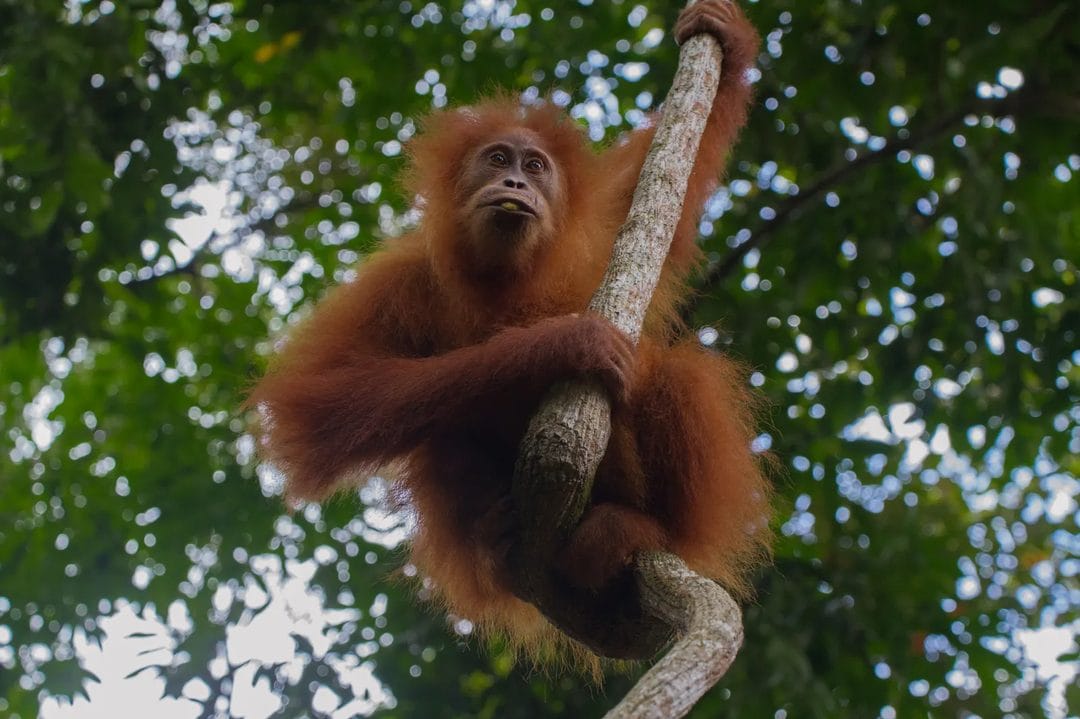
On 7 August, FireWatch detected fires at the edge of the Sungai Putri peatland forest in West Kalimantan's Ketapang district, home to an estimated 750 to 1,750 Bornean orangutans and the third-largest population of the species in the province, Mongabay reported. The rescue organisation YIARI, which operates an orangutan rehabilitation centre in the area, said fires near the centre were extinguished in the early hours of 12 August, though smoke lingered afterward. Earlier in July, authorities and conservationists rescued a male orangutan from farmland near an expanding blaze in the same district.
Prolonged fires can reduce food availability for orangutans and force them into farmland in search of it, while smoke exposure weakens their immune systems, according to research cited by Mongabay. The environmental group Madani Berkelanjutan estimates that about 22,200 hectares of the area burned so far this year fall within key biodiversity zones nationwide.
Funding for prevention varies sharply by province. In Riau, one of Indonesia's most fire-prone regions, the 2026 budget for fire management totals just 3.67 billion rupiah, or roughly 205,500 dollars, according to Gusmansyah, deputy coordinator of the Riau-based NGO FITRA Riau, which tracks government spending. He described the allocation as inadequate given the province's history of severe fire and haze events.
Fire Season Yet to Peak
BMKG's own projections suggest the current toll is an early chapter rather than the season's peak. Burning in Indonesia typically increases through August before reaching its historical maximum in September and October, and the agency expects suppressed rainfall to persist over Kalimantan, Sumatra, Jambi and West Kalimantan through at least October. Several regions had already gone more than 60 consecutive days without rain as of BMKG's 30 July briefing, a dry spell the agency says is consistent with the atmospheric pattern that preceded the 2015 fire season.